


Cary Voting District, Sharkey County, Mississippi
About
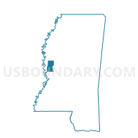
Outline

Summary
| Unique Area Identifier | 606624 |
| Name | Cary Voting District |
| County | Sharkey County |
| State | Mississippi |
| Area (square miles) | 111.51 |
| Land Area (square miles) | 110.89 |
| Water Area (square miles) | 0.62 |
| % of Land Area | 99.44 |
| % of Water Area | 0.56 |
| Latitude of the Internal Point | 32.76007410 |
| Longtitude of the Internal Point | -90.88324400 |
Maps


Graphs
Select a template below for downloading or customizing gragh for Cary Voting District, Sharkey County, Mississippi


Neighbors
Neighoring Voting District (by Name) Neighboring Voting District on the Map
- Rolling Fork 1 Voting District, Sharkey County, MS
- Rolling Fork 2 Voting District, Sharkey County, MS
- Spanish Fort Voting District, Sharkey County, MS
- Tallula Voting District, Issaquena County, MS
- Valley Park Voting District, Issaquena County, MS
Top 10 Neighboring County Subdivision (by Population) Neighboring County Subdivision on the Map
- District 3, Sharkey County, MS (1,367)
- District 1, Sharkey County, MS (1,143)
- District 2, Sharkey County, MS (700)
- District 1, Issaquena County, MS (240)
- District 2, Issaquena County, MS (176)
Top 10 Neighboring Place (by Population) Neighboring Place on the Map
Top 10 Neighboring Unified School District (by Population) Neighboring Unified School District on the Map
Top 10 Neighboring State Legislative District Lower Chamber (by Population) Neighboring State Legislative District Lower Chamber on the Map
Top 10 Neighboring State Legislative District Upper Chamber (by Population) Neighboring State Legislative District Upper Chamber on the Map
Top 10 Neighboring 111th Congressional District (by Population) Neighboring 111th Congressional District on the Map
Top 10 Neighboring Census Tract (by Population) Neighboring Census Tract on the Map
- Census Tract 9501, Sharkey County, MS (2,897)
- Census Tract 9502, Sharkey County, MS (2,019)
- Census Tract 9501, Issaquena County, MS (1,406)